The East Australian Current
The East Australian Current is the largest ocean current close to the coasts of Australia, generating and enriching life on the driest continent. With its source in the tropical Coral Sea, north-east of Queensland, the East Australian Current (EAC) moves a substantial volume of low-nutrient tropical water south down the Australian coastline towards the temperate regions, with ocean eddies peeling off into the Tasman Sea on the way.Few Australians realise the EAC is especially relevant to their lifestyle and livelihood - renewing fish stocks and aiding fisheries sustainability; dispersing effluent and marine pollution from coastal cities and renewing water quality; providing a "comfortable" water temperature for beachgoers, swimmers and surfers; and for assisting yachts sailing south in the Sydney to Hobart yacht race.
The Life of a Current
One of the earliest European records of an ocean currrent off the Australian coast was made by Captain James Cook on his South Pacific voyage of discovery. In his log of 15 May, 1770 when nearing Cape Byron, he wrote: "Winds southerly, a fresh gale'. Searching for more sea room, he headed offshore until, "having increased our soundings to 78 fathoms, we wore and lay with her head in shore until 5 o'clock a.m., when we made sail. At daylight we were surprised by finding ourselves father to the southward than we were in the evening, and yet it has blown all night southerly".
Cook reported a southgoing current of less than a knot from his noon latitude fixes ever since he started sailing inshore and northward along the New South Wales coast. Near Cape Byron, he had probably met the full force of the East Australian Current.
With current speeds of up to five knots, the EAC is a major current system. It is one of the co-called "western boundary" currents of the world - those current systems squashed against the western side of the ocean by the Earth's rotation. The other major western boundary currents are the Gulf Stream off the United States, the Kuroshio off Japan, the Agulhas (African coast) and the Brazil Current, off South America.
The source of the EAC is in the Coral Sea. It takes the form of a surface stream, tens of metres deep, that runs towards Australia along the boundary between the Coral and Tasman seas. Because the Coral Sea waters are warm (29 degrees-31 degrees C) and have a low density, the Coral Sea is almost a metre higher than the Tasman Sea.
Currents tend to follow contours of sea-surface elevation which are evident from satellite altimeter images. The slope created between the different water masses gives strength to the current, in the same way as winds are strongest where the pressure changes are greatest.
On its southward run, the EAC frequently crosses onto the continental shelf and moves close inshore. At times it sets up northward-flowing currents on the shelf spinning off small clockwise-rotating "cold core" eddies. The boundary also fluctuates, advancing and retreating, and leaving behind large anti-clockwise rotating warm-core eddies with currents of up to four knots at the edge.
Features of a current
The EAC is the largest ocean current close to the coast of Australia.
Scientists have been studying it for perhaps 100 years, although for the first 60-70 years they focused on the biology and how it may be influenced by the current. However, in the last 25 years real advances have been made in understanding the chemical make-up of the EAC, its physical structure and seasonal changes, and more recently its influence on the biodiversity of the east coast.
With the technology of the 1990s, a profile of the EAC - at the surface, from the surface to the ocean floor, and across the continental shelf - is being developed. Those advances have come from research vessels, earth observation satellites, and ocean monitoring and measuring equipment.
Finally, powerful computers, combined with the observations, enable scientists to model how the EAC influences life offshore and onshore, and in the coastal zone. For example, environmental and resource managers use the models to simulate coastal water movement and its effects on sewerage outfalls, oil spills, commercial fisheries, shipping and transport, and defence.
What scientists already know is that the East Australian Current:
ferries up to 30 million cubic metres per second, with a strong influence to 500 metres depth and 100 kilometres width.
the current is strongest in summer, peaking in February, and weakest (by as much as half the flow) in winter,its energy dissipating east of Tasmania.
generates ocean eddies as broad as 200 kilometres across, rotating mainly anti-clockwise at up to four knots at the edge; these can be more than one kilometre deep and have a life of up to a year
frequently crosses onto the continental shelf and moves close inshore
causes upwellings where it moves away from the coast at places like Cape Byron, Smoky Cape and Sugarloaf Point, drawing nutrient-rich water from a depth of 200 metres or more
can be slowed down or reversed by southerly winds within 10 nautical miles of shore.
By comparison, the Leeuwin Current off Western Australia carries a quarter as much water, peaking in May-June.
Life with the current
The variability of the East Australian Current (both season-to-season and year-to-year) is well known to fishermen and sailors, but the reasons for this variability are poorly understood.
For example, what are the biological implications of an EAC that, in winter, is half its normal summer flow and differs from year to year? Why, during the peak of winter, does it reach a point off New South Wales and turn away from the coast into the Tasman Sea? And why should that geographical point also vary season to season and year to year.
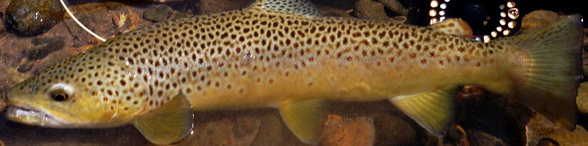
The separation of the current from the coast is described by gemfish fishers as "unzipping.'The gemfish run and spawning are thought to be closely linked to it. Gemfish stocks have been under pressure. Daily landings in 1997 when there was a total allowable catch of 1,000 tonnes, were 50 per cent lower than in 1996. Fishers claimed this was partly because the EAC behaved unfavourably for catching fish.
In a 1997 research project for the Fisheries Research and Development Corporation, links between oceanographic factors and catching rates were confirmed by using satellites to monitor sea-surface temperatures. Industry surveys in both 1996 and 1997 reflected the changing fishing patterns of the gemfish fleet, and the effect on catchability of oceanographic conditions in 1997.
The study also indicates that the location and timing of gemfish aggregations are determined by the annual north-south oscillations of the EAC, with gemfish aggregations forming where the sub-Antarctic and south-west Tasman waters meet.
How else does the EAC influence life along Australia's eastern seaboard? Increasingly, the fishing industry is using satellite images to improve their catching efficiency. For more than 20 years, earth observation satellites have been feeding back images of the world's oceans. These images clearly recognise features at the surface such as warm ocean currents, the upwelling of cold water and nutrients nearer the coast and now, a view from space of the productivity of the oceans.
Australian marine biologists and oceanographers can assess productivity by the extent of phytoplankton (minute single-cell plants that form the foundation of the ocean food chain). The assessment is done by measuring the colour of the ocean reflected in satellite images and checking it against samples collected from ships. This water, which can be 5 degrees C cooler; turns green after sunlight causes phytoplankton to grow. The nutrient-poor deep water of the EAC is a clear blue.
The areas of high production shift in response to the passage of storms and ocean current systems. For the east coast tuna fishery and other fisheries, ocean colour images offer much promise in enabling scientists and the industry to understand the dynamic processes controlling phytoplankton and fish distribution. This understanding is critical for effective management of the resource.
Knowledge of the EAC is of interest to Australian coastal and international shipping. Information on ocean conditions can potentially save shipping millions of dollars. Ships" masters use the satellite information and interpretation of ocean currents and eddies to optimise their course and speed.
Using satellites which measure the topography of the ocean caused by ocean currents and eddies, CSIRO scientists have taken the first steps towards ocean mapping. The weekly series of sea-level maps has a precision of 5 cm. They are equivalent to the now-familiar pressure maps of the atmosphere and represent the "weather" of the sea.
Sea-level variations are related to eddies and currents just as atmospheric pressure highs and lows drive winds. A technique has been developed in which maps of sea-level can be translated into temperature and salinity anomalies, from the surface to a depth of about two kilometres.
In defence support, the new advance in ocean mapping techniques refines the "night eyes" for submarine commanders, where altered ocean conditions such as varying densities can significantly affect sonar and radar.
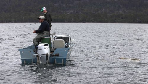
At a recreational level, skippers and navigators in the Sydney-Hobart yacht race and other major east coast yacht races are briefed by Dr Cresswell on current conditions. Sailors are especially interested in knowing the strength of the current and the location of ocean eddies, together with other weather information.
For example, the combination of wind and current in the 1993 Sydney to Hobart Race led to the retirement of two-thirds of the race fleet. The EAC was flowing south at three knots towards a low pressure system in Bass Strait where the south-easterly winds were blowing at 50 knots, amplifying the already high seas. Competitors in the 1998 event, in which six sailors died, experienced a similar combination of a strong southward-flowing EAC and winds to 70 knots.
Summary
With the East Australian Current such a dominant natural feature of the Australian environment, there are broad benefits in understanding its influences. Shipping, fisheries, defence, recreational boating and search and rescue will benefit from the new studies to more clearly identify the pattern of currents and eddies and eliminate gaps in knowledge about the coastal, shelf and offshore currents.
Just as importantly, our knowledge of the complexities of ocean patterns - from deep-water upwellings, to internal waves bouncing off undersea mountains, to the broader influence ocean currents have on climate - is adding to the comprehensive picture oceanographers are building of an environmental, economic and recreational asset.
Additional information: http://www.marine.csiro.au http://www.marine.csiro.au/~lband/SEAWIFS/index.html http://www.marine.csiro.au/~lband/iotd.html To check sea surface temperatures around the Australian coastline, access the following site - http://www.marine.csiro.au/~lband/web_point/